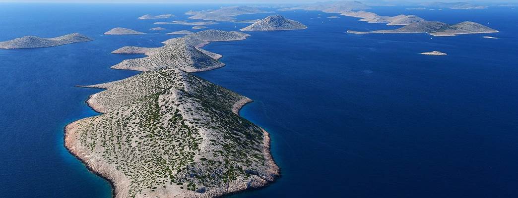
In 2003-2004 the State Geodetic Administration of the Republic of Croatia (DGU) and Norwegian Mapping Authority (NMA) launched a project called CRONO-GIP II. The working method in this project was to digitize all cadastral maps by scanning them with very precise laser scanners. The objective of the project was to enable sustainable use of the Kornati Islands National Park.
Norway has supported the Dinaric Arc Parks project through WWF. This was a three-year long project established to protect and connect vulnerable areas in the region. WWF started the project Dinaric Arc Parks in early 2012, with the aim to create an association of nature and national parks in the territory of Albania, Bosnia and Herzegovina, Croatia, Kosovo, Macedonia, Montenegro, Serbia and Slovenia. This three-year project was funded by the Norwegian Ministry of Foreign Affairs and the MAVA Foundation. Capacity building and trainings were important aspects of this project. In Croatia, all 19 Croatian National and Natural Parks joined to Parks Dinarides Protected areas association, a Protected Areas Benefit Assessment was made and published for all of them, the European Charter for Sustainable tourism was awarded to two protected Areas in Croatia, and a Conference of Protected Areas of Western Balkan was held in National Park Brijuni.
Photo: WWF Adria